
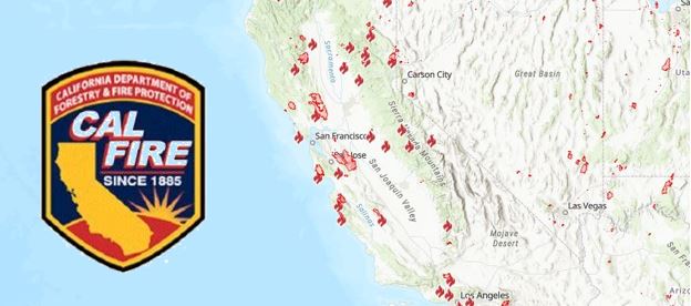
As of today, Sunday Aug. 23, over 14,000 firefighters are on the front-lines of more than two dozen major fires and lightning complexes across California. Last night, firefighters aggressively worked to strengthen containment lines. In anticipation of the upcoming weather patterns, crews continue to perform firing operations to burn away vegetation in an attempt to slow down and stop the spread of the wildfires.
Since the lightning siege that started on Saturday, August 15, 2020, there have been nearly 12,000 lightning strikes. During this time-period, there have been more than 615 new wildfires, which have now burned over 1.1 million acres. All current active wildfires, across all jurisdictions, have burned nearly 1.3 million acres across California.
The weather forecast for the upcoming days continues to be warm and dry. Remnants of Hurricane Genevieve will bring thunderstorms as early as this morning and continue through Tuesday. A Red Flag Warning has been issued by the National Weather Service for lightning with very little to no rain. The winds will generally be light, however erratic gusty winds of up to 65mph may occur. This dry lightning will likely hamper efforts to contain the current fires and may spark new fires.
With extreme fire danger expected this weekend, it is critical that all Californians take steps to prevent sparking a wildfire. To learn more ways to prevent sparking a wildfire visit www.ReadyForWildfire.org.
Close Fires of Interest:
River Fire, Monterey County (more info…)
East of Salinas
*48,424 acres, 15% contained
*16 structures destroyed
*Evacuations in place
*CAL FIRE IMT Team 1 in command
Carmel Fire, Monterey County (more info…)
South of Carmel
*6,695 acres, 10% contained
*32 structures destroyed
*Evacuations in place
*CAL FIRE IMT 1 Team in command
**CAL FIRE Incidents**
LNU Lightning Complex Fire, Napa County (more info…)
Napa County
State DPA, SRA, Napa County
* 341,243 acres, 17% contained
*Hennessey (merged fires) 261,793 acres, 15% contained
*Wallbridge 50,069 acres, 0% contained
*Meyers 2,345 acres, 0% contained
*Estimated 560 structures destroyed
*Evacuations in place
*CAL FIRE IMT-2 in command
SCU Lightning Complex Fire, Contra Costa, Alameda, Santa Clara and Stanislaus Counties (more info…)
Contra Costa, Alameda, Santa Clara and Stanislaus Counties
* 339,968 acres, 10% contained
*20 fires in the complex
*Marsh 3,000 acres
*Canyon/Reservoir (merged) 285,485 acres
*Deer 3,294 acres
*Arroyo 189 acres
*Evacuations and road closures in place
*5 structures destroyed
*CA IMT-6 in command
CZU August Lightning Fire, San Mateo and Santa Cruz Counties (more info…)
San Mateo and Santa Cruz Counties
*71,000 acres, 8% contained
*Warnell Fire has now merged into CZU Lightning
*Evacuations in place
*97 structures destroyed
*CAL FIRE IMT #3 is in command
BTU/TGU Lightning Complex Fire, Butte and Glenn Counties (more info…)
Butte, Tehama and Glenn Counties
*52,262 acres, 20% contained
*Elkhorn 33,000 acres
*Ivory 12,500 acres
*Potters (5-4) 1,012 acres
*CAL FIRE IMT- 4 in command
Moc Fire, Tuolumne County (more…)
Moccasin
• 2,800 acres, brush, 10% contained
• Continued structure threat
• Evacuations in place
Salt Fire, Calaveras County (more info…)
Northeast of Copperopolis
*1,789 acres, 85% contained
Hills Fire, Fresno County (more info…)
South of Coalinga
*2,121 acres 94% contained
Jones Fire, Nevada County (more info…)
Northwest of Nevada City
*705 acres, 55% contained
*Evacuation in place
*5 residential structures destroyed
**Unified Command Fires**

Lake Fire, Los Angeles County (more info…)
Southwest of Lake Hughes
* 31,089 acres, 52% contained
*Continued structure threat
*Unified Command USFS and Los Angeles County Fire
*CA IMT Team 5 is in command
**Federal Incidents**
August Complex, Tehama County (more…)
Grindstone Canyon, Elk Creek
* 160,005 acres 11% contained
Dolan Fire, Monterey County (more info…)
Ventana Wilderness – Los Padres National Forest
*19,278 acres, 10% contained
Ranch 2 Fire, Los Angeles County (more info…)
San Gabriel Canyon
*4,237 acres, 49% contained
*Road closures in place
*Federal Type 2, in command
Apple Fire, Riverside County (more info…)
Cherry Valley
*33,424 acres, 95% contained
North Complex Fire, Plumas County (more info…)
Southwest of Susanville – Plumas National Forest
*27,701 acres, 5% contained
*Evacuations in place
* Includes the Claremont Fire
*Road and trail closures in effect
*CA IMT Team 1 is in command
Loyalton, Vegetation Fire, Sierra County (more info…)
East of Loyalton – Tahoe National Forest
* 47,028 acres, 75% contained
Red Salmon Complex – Shasta-Trinity National Forest (more info…)
Northeast of Willow Creek, CA
*18,960 acres, 39% contained
Castle Fire, Tulare County (more…)
East of Giant Sequoia National Monument
*3,800 acres, brush and timber, 0% contained
W-5 Cold Springs, Lassen County (more…)
East of Madeline.
*22,000 acres, 10% containment
Dome, San Bernardino County (more…)
Mojave National Preserve
*43,273 acres, 95% contained
Beach, Inyo County (more…)
Inyo National Forest
*3,780 acres, 80% contained
Blue Jay/Wolf Fire, Mariposa County (more…)
Yosemite National Forest
*340 acres, 10% contained
Hull Fire, Glenn County (more…)
North of Lake Pillsbury
*2,000 acres
Woodward Fire, Marin County (more…)
Point Reyes National Seashore
*2,689 acres 5% contained
**Local Government**
Holser, Vegetation Fire, Ventura County/Los Angeles County (more info…)
FINAL
South of Lake Piru
*3,000 acres, 100% contained